Patterns of soil moisture, observed by satellite, are helping us to pinpoint the locations where thunderstorms will form.
Testbed 3 is pioneering the use of these land surface observations as part of the process of ‘nowcasting’ for the Sahel zone in Africa.
Nowcasting refers to a forecasting process where we provide short-term predictions of severe weather over the next few hours, based on current observations. These observations can enable forecast users to take action to protect themselves and their livelihoods from the effects of severe weather.
SWIFT is bringing nowcasting solutions to Africa for the first time.
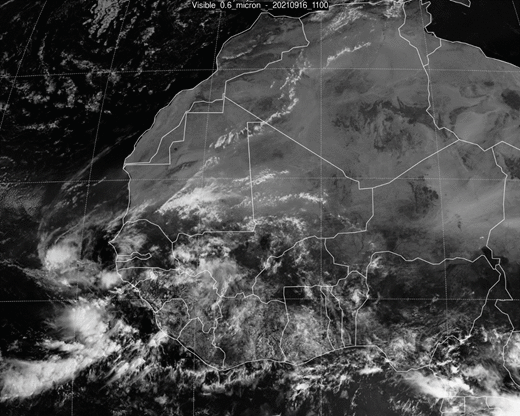
Initial interest in a line of cloud near the “neck” of SW Niger at 1100, 1200. By 1300, warm convective clouds became evident further east (near
Tahoua ) and far SE of country.
By 1400, starting to see the large-scale convergence line (presumably ITD) running from N Mali to NE Nigeria which was dominant feature of subsequent
deep convection.
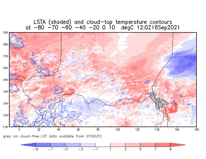
Early convection (1400) developed in locations with warm LSTA and/or near cool (wet) LSTA features,
consistent with previous day
These deepened rapidly (eg 1500 image), propagating towards SW, with coldest temperatures (defined as convective cores by mid afternoon) tending to develop over warmer (drier) surfaces, as expected
Christopher Taylor (UKCEH) with material and ideas from
Cheikh Dione (ACMAD),
Nafissa Dignon and Abdoul Aziz (DMN Niger),
Douglas J Parker and Beth Woodhams (University of Leeds)