The African SWIFT Synoptic Forecasting and Nowcasting Testbed was the first of its kind in tropical Africa, which provided a unique opportunity for forecasters and researchers to come together in a quasi-operational environment to test and evaluate new tools and methods for forecasting weather, including high-impact weather, on time scales from a few hours to a few days. Prior to this, weather forecast models had little to no skill in forecasting tropical rainfall on these timescales, but the new approaches in the testbed brought real improvements in forecasts.
In Testbed 1, our team spent several weeks in early 2019 forecasting and nowcasting around the clock in Nairobi, Kenya. African SWIFT researchers and forecasters collaborated to test the use of satellite-based systems for nowcasting — predictions of rainfall in the coming hours, based on the current conditions — and very high-resolution weather forecasting models for high-impact weather forecasts. Both demonstrated potential for significant improvements in high-impact weather warnings and general rainfall forecasts.
Testbed 3 expanded on the knowledge from Testbed 1 while working with specific user groups to tailor forecasts to their needs. The testbed aimed to deliver real improvement, not just in forecast quality, but also in how useful the information provided is to specific users including disaster management agencies, water resources organisations, fishers, and the public.
Key Dates
- Testbed 3 Pre-Event & Training:
17th – 28th May 2021 - Testbed 3 Main Event:
13th-28th September 2021 (Senegal, Ghana, Niger)
20th – 28th September 2021 (Nigeria)
25th October-5th November 2021 (Kenya)
*All Testbed 3 events were held virtually or partially virtually to ensure COVID-19 safety.
Testbed Archives
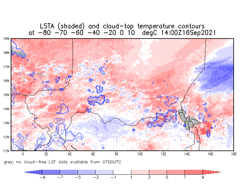
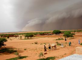
Using positive land surface temperature anomalies to predict the location of convection in Niger
Patterns of soil moisture, observed by satellite, are helping us to pinpoint the locations where thunderstorms will form. Testbed 3 is pioneering the use of these land surface observations as part of the process of ‘nowcasting’ for the Sahel zone in Africa. Nowcasting refers to a forecasting process where we provide short-term predictions of severe…
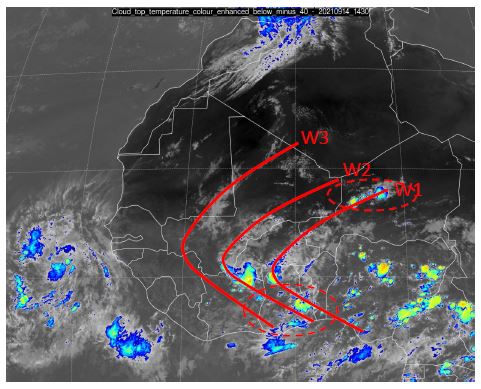
Gravity waves, land surface and convective initiation
Close analysis of the weather situation among the researchers and forecasters in SWIFT Testbed 3 has been uncovering some of the processes and patterns controlling the development of thunderstorms in West Africa. By looking at the patterns of clouds and storms as they develop during the day, and relating these to patterns of soil moisture…
Continue Reading Gravity waves, land surface and convective initiation
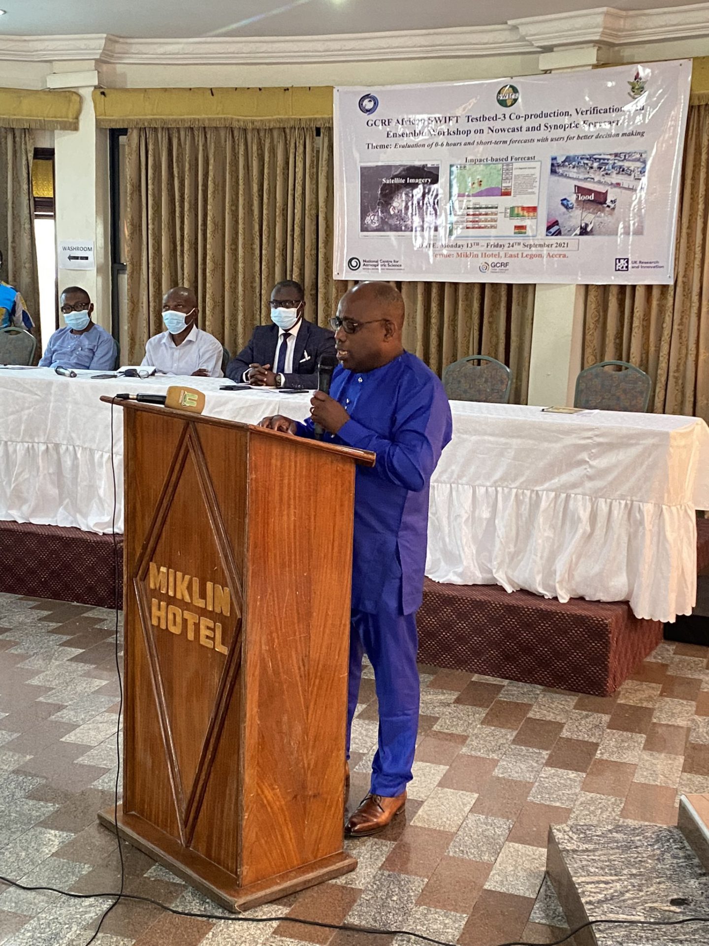
Testbed 3 Opening Speeches
With the launch of Testbed 3 this week, we have heard some inspiring speeches from our Ghanaian Partners Professor Benjamin Lamptey AG. Director-General of the Ghana Meteorological Agency Professor Leonard K Amekudzi
GCRF African SWIFT Testbed 1 Report
Testbed 1 was conducted in the first part of 2019, from an operational forecasting office at IMTR Nairobi, at the Kenya Meteorological Department (KMD). The Testbed was designed to support SWIFT’s programme of research capability-building in the science of weather prediction. New forecasting and evaluation products were tested. The outcomes of the Testbed will be…
Do convection-permitting ensembles lead to more skilful short-range probabilistic rainfall forecasts over tropical East Africa?
By Dr Carlo Cafaro for GCRF African SWIFT Most of the rainfall in the tropical Africa region comes from convective systems. Forecasting convection is both challenging and crucial – slight changes in surface temperatures, cloud amounts, or winds aloft can drastically affect the timing, location and intensity of the convection. Thus, convective rainfall forecasts can…
Intensive training equips forecasters to better predict Africa’s severe storms
By Dr Jennifer Fletcher for GCRF African SWIFT High-impact weather leads to devastating losses in tropical Africa each year. Precipitation forecasts from weather-prediction models remain very poor, and existing tools for very near-term prediction remain under-utilised. In September, African SWIFT is undertaking Testbed 3, an intensive two-week trialling of new approaches and tools to short-term,…
Continue Reading Intensive training equips forecasters to better predict Africa’s severe storms
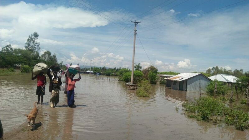
European satellite data key to African nowcasting
Throughout Africa, lives and livelihoods are directly impacted by weather- and climate-related risks. Strengthening national meteorological and climate science capacities holds transformational potential for building climate-resilience across the continent in the coming decade. Nowcasting capability and capacity is an essential part of this goal, delivering warnings and alerts of highly unstable African storms minutes to…
Continue Reading European satellite data key to African nowcasting
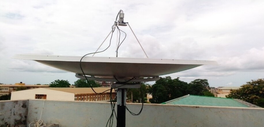
How a satellite dish can save lives: Ghana advances nowcasting to improve early weather warnings
By Dr. Jeffrey Nii Armah Aryee, Lecturer and Researcher at KNUST, Kumasi, Ghana Accurate weather forecasting is an essential tool of modern society, which brings benefit to human safety and livelihoods, along with economic development and prosperity. The Nowcasting Satellite Facility (NWC-SAF) provides various products that are useful for improving nowcasting potential in Africa. Ghana…
Satellite observations hold key to Africa’s short-range weather forecasts
By Dr Peter Hill, University of Reading New research demonstrates that satellite observations across Africa can be used to provide valuable forecasts of storm evolution in subsequent hours. Large populations in tropical Africa are vulnerable to severe weather, often caused by intense storms that can generate heavy rainfall, strong winds and flooding. Forecasts can be…
Continue Reading Satellite observations hold key to Africa’s short-range weather forecasts
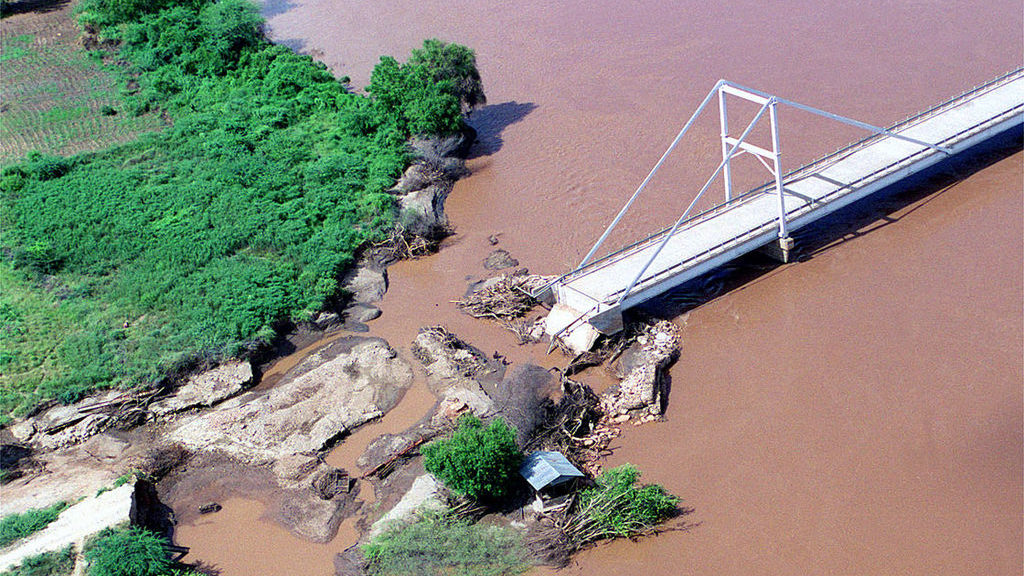
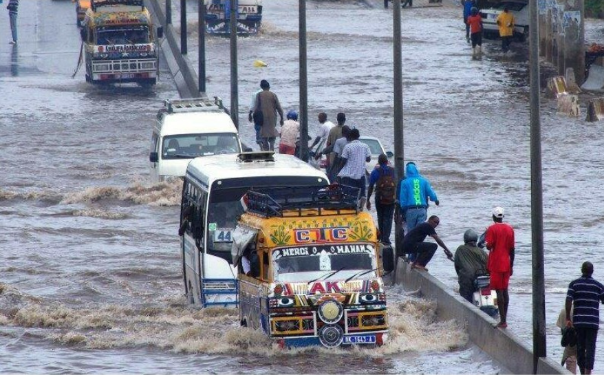
New research will improve early warning of devastating megastorms
With files from Simon Williams, UK CEH Ground-breaking scientific research will make it easier to predict the path of some of the world’s most powerful storms, enabling communities to better protect themselves from severe flooding. Mesoscale convective systems (MCSs) are ‘megastorms’ that affect large parts of the world, including Africa, Australia, Asia and the Americas,…
Continue Reading New research will improve early warning of devastating megastorms