By Jemimah Gacheru (KMD), Chris Kiptum (KMD), David Koros (KMD), Caroline Wainwright (Reading), John Marsham (Leeds) for GCRF-African SWIFT
Several lakes in Kenya’s Rift Valley have reached record levels, causing concerns for livelihoods and ecology in the region. Lake Baringo and Lake Bogoria, once 20 kilometres apart, are now so close there are fears one could contaminate the other. As one is saline (Bogoria), and the other is freshwater (Baringo), this could lead to significant ecological problems. Thousands of acres of farmland and homes have already been lost, and homes inundated as the lakes continue to expand.
There are also fears that the Turkwel Dam, located along the Turkwel River and which flows into Lake Turkana in north-western Kenya, may overflow following ongoing rainfall in Mount Elgon, the source of its water. The situation is compounded by the fact that Lake Turkana’s water levels have risen and displaced more than 1000 households while damaging hotels and government offices.
Exceptional rainfall responsible for rising lake levels
Most of these lakes found in the river valley don’t have outflow. Exceptional rainfall has led to the high lake-levels, although other factors may also have played important roles, including deforestation, siltation, and possible seismic shifts that may have raised the floors of the lakes and rivers.
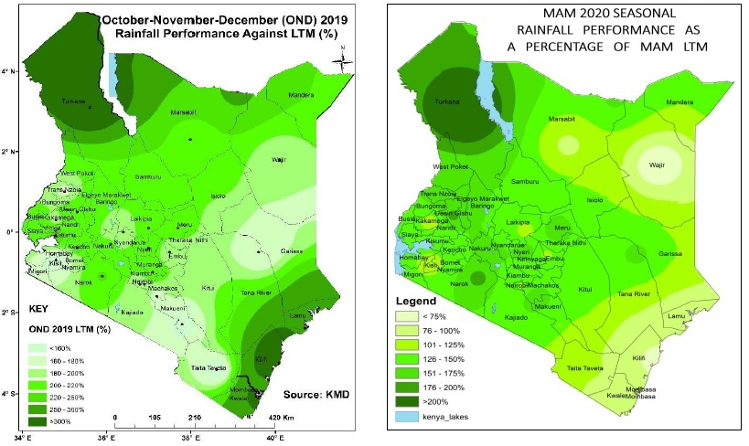
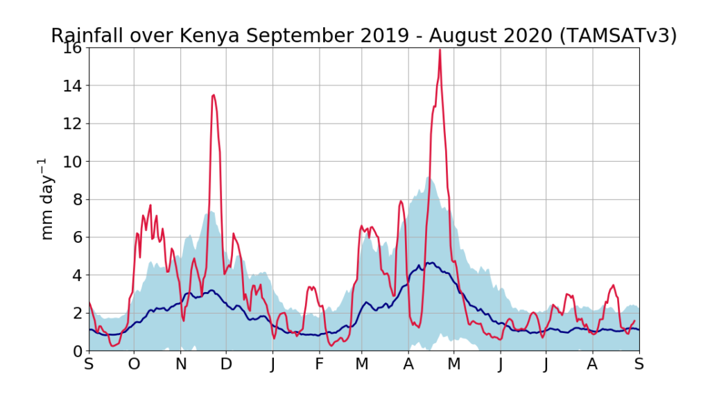
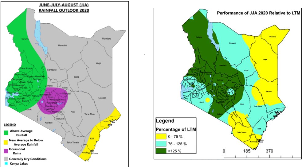
Kenya normally experiences a ‘dry period’ between the Short and Long rains seasons but there was no break in rainfall between the OND short rains of 2019 and the MAM long rains of 2020, which were both themselves exceptionally wet (Figure 1,2). Moreover, substantial rainfall has been received over western Kenyan and the central Rift Valley (which are catchment areas for the lakes) during the JJAS season (Figure 2,3).
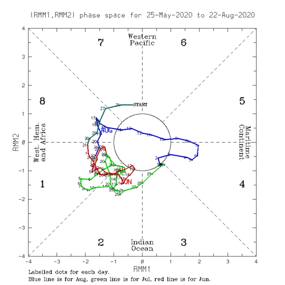
The above average rainfall during the 2019 short rains was related to above average sea surface temperatures in the western Indian Ocean. The recent wet conditions in June and July 2020 may be related to the Madden-Julian Oscillation (Figure 4) and/or the current weak La Nina.
Forecasts predicted rainfall in advance
Above average rainfall for June-July 2020 was forecast in advance. The 55th Greater Horn of Africa Climate Outlook Forum (GHACOF) in late May 2020 forecast wet conditions over the region, based upon the cooling sea surface temperatures in the tropical Pacific Ocean.
The June-July-August forecast issued by the Kenya Meteorological Department (28 May 2020) showed that western Kenya was likely to receive above-average rainfall (Figure 3). This was confirmed by data from stations within the catchment areas of the two lakes which showed that severe storms occurred as predicted. For instance, Katimok KFS in Baringo County recorded 70.8mm of rainfall on 5 July 2020 while Kabarnet DC within the same county recorded 51.1mm of rainfall on 17 July. Both stations received more than 600mm of rainfall between June and July 2020.
Contact
For more information, contact Lauren Phillips, Communications Officer for GCRF-African SWIFT at [email protected].